

Take a breath. Before you read a single line about dams or scarcity, I want you to know something: this chapter is one of the friendliest in the whole Class 10 Geography book. There are no formulas to memorise, no numerical problems that go wrong at step four, and no diagrams you have to draw from memory. What there is — and what makes some students nervous — is a lot of names, a lot of opinions, and a map. That is all. Names can be learned. Opinions can be organised. Maps can be practised. By the time you reach the bottom of this page, all three will feel ordinary.
Let me tell you why this chapter is worth genuinely enjoying rather than merely surviving. Water Resources is the chapter where Geography stops being a list of facts and starts being an argument. You will meet engineers who believed a concrete wall across a river could lift millions of people out of hunger. You will meet farmers who lost the fields their great-grandparents ploughed so that wall could be built. You will meet a desert village that has quietly solved its own water problem with a technique older than the British Empire. Nobody in this story is a cartoon villain. That is exactly what makes it a good chapter — and exactly what the board examiner is hoping you will notice.
Here is the honest emotional truth about how most students feel right now. You have probably flipped through this chapter and thought: there are eight dams I have to remember, and they all sound the same, and I will definitely put the wrong one on the wrong river. I promise you that fear is fixable, and we are going to fix it properly — not with panic-cramming the night before, but with a memory system that ties every dam to a river and a state so tightly that forgetting becomes difficult. Do not skip ahead to that section yet. The map makes far more sense once you understand why anybody built these dams in the first place.
One more thing before we start. This chapter asks you to hold two ideas at once: dams have done enormous good, and dams have done real harm. Some students find that uncomfortable. They want to know the “right” answer so they can write it down. In this chapter, the right answer is holding both ideas at once, fairly and calmly, and then saying what you conclude. That is a grown-up skill, and you are ready for it. Let us begin.
What You Will Learn
- Water as a Renewable Resource: The Hydrological Cycle
- Water Scarcity: What It Is and What Causes It
- Water Quality and Pollution as a Form of Scarcity
- Why Conserve and Manage Water?
- Multi-Purpose River Projects and the Functions They Serve
- Dams Through History and the Temples of Modern India
- The Case FOR Multi-Purpose Projects
- The Case AGAINST: Criticisms and Consequences
- Movements and Disputes: Narmada Bachao Andolan and Water Conflicts
- Map Skill: Locating India’s Major Dams
- Rainwater Harvesting: Traditional Indian Systems
- Modern Rooftop Harvesting and Community Success Stories
- Sustainable Water Management: What a Balanced Answer Looks Like
- Practice Worksheet with Answers
Your Game Plan
Students who do well in this chapter are not the ones who read it the most times. They are the ones who read it in the right order. Here is the order I would use if I were sitting next to you.
- Read the first four sections slowly and do not take notes yet. Just let the idea of “scarcity is not only about rainfall” sink in. This single idea unlocks about a third of the questions asked from this chapter.
- Learn the two sides of the dam debate as a pair, never separately. Make a two-column page: benefits on the left, costs on the right. Every time you learn a benefit, immediately learn the objection that sits opposite it. They stick better in pairs.
- Do the map section with an actual blank outline map in front of you. Not a photograph of one. Print or buy three or four, and mark the eight dams on a fresh one every few days. Reading about map work does almost nothing; marking does almost everything.
- Learn the traditional harvesting systems by region, not as a list. Rajasthan things together, Himalaya things together, north-east things together. Your brain files by place far more reliably than by alphabet.
- Attempt every worked example on paper before you read the model answer. Yes, every one. Reading a good answer feels like learning but usually is not. Writing a bad answer and then comparing it to a good one absolutely is.
- Finish with the worksheet at the end, closed-book, timed. Then mark yourself honestly against the answers provided.
You may have heard from an older sibling, a tuition senior, or an old guide book that “Water Resources is only for map work, you can skip the theory.” That advice is out of date, and following it would be expensive. For the CBSE Class X Social Science curriculum for 2026-27 (Subject Code 087), Water Resources is examinable in full — both the theory and the map. Geography contributes 20 marks in total, made up of 17 marks of theory and 3 marks of map pointing. So the descriptive questions from this chapter are live, and the dams are live too. Prepare both. If somebody tells you otherwise, they are quoting a syllabus from a different year.
Water as a Renewable Resource: The Hydrological Cycle
Let us start with something you already know but have probably never been asked to say out loud: the water on Earth never runs out. Not ever. The same water that a dinosaur drank is still here. It has been a cloud, a puddle, a glacier, a cup of tea, a river and the sea, many thousands of times over. Nothing about that process destroys water. It only moves it around and changes its form.
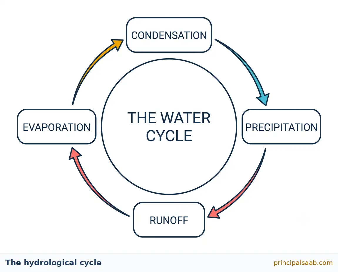
That constant moving-around has a name: the hydrological cycle, sometimes called the water cycle. Here is how it works, told simply. The sun heats the oceans, lakes, rivers and wet soil. Water at those surfaces turns into invisible vapour and rises — that is evaporation. Plants add their own contribution, pulling water up through their roots and releasing it from their leaves — that is transpiration. High up, where the air is colder, the vapour cools and gathers into tiny droplets around specks of dust — that is condensation, and it is what clouds are made of. When the droplets grow heavy enough, they fall as rain, snow, sleet or hail — that is precipitation. On the ground, some of that water runs downhill into streams and rivers and eventually back to the sea — run-off. Some soaks into the soil and travels slowly downward into the rock below — infiltration, which is how underground water is topped up. And then the sun goes to work again and the whole thing repeats.
Because this cycle keeps refilling our rivers, lakes and underground stores, water is classified as a renewable resource. Coal is not renewable: burn a tonne and that tonne is gone for good. Water is not like that. Use a bucket of it and, in time, the cycle brings you another one.
And now we arrive at the single most important sentence in this entire chapter, so I want you to slow down for it.
Water renews itself at a fixed speed set by nature. If we take it out faster than the cycle puts it back, we run short — even though the resource is technically renewable. Renewability tells you the tap refills; it does not promise the tap refills as fast as you are drinking.
Here is an analogy I like, because it turns an abstract idea into something you have actually experienced. Imagine your pocket money. Suppose you receive five hundred rupees on the first of every month, reliably, forever. Your income is renewable — it comes back every single month without fail. But if you spend eight hundred rupees a month, you are in trouble by March. The money being renewable did not save you. What mattered was the rate: how fast it arrives versus how fast it leaves. Water works exactly like that. The hydrological cycle is our monthly allowance. Over-pumping a borewell is spending eight hundred.
There is a second reason “renewable” can mislead you, and it is about where and what kind. Most of the water on this planet is in the oceans and is far too salty to drink or to irrigate a field with. Of the small remainder that is fresh, a large share is locked away as ice near the poles or sits deep underground in places we cannot easily reach. The genuinely usable, accessible freshwater in rivers, shallow groundwater and lakes is a thin slice of a thin slice. So when a question asks you why a renewable resource can still be scarce, you have two clean answers ready: rate (we withdraw faster than nature replaces) and form and location (most water is salty, frozen or out of reach).
A third point, often forgotten, is timing. India receives a great deal of rain, but most of it arrives in a handful of monsoon months and then stops. A river that is a roaring flood in August can be a sandy trickle in April. So even a well-watered region can be genuinely short of water for part of the year. That mismatch between when water arrives and when we need it is precisely the problem that dams and rainwater harvesting both try to solve — one by storing water in a big reservoir, the other by storing it in tanks and in the ground. Keep that thought; it will tie the whole chapter together.
Students write this every year and lose marks for it. Renewability is about replacement, not about abundance. Always follow the word “renewable” with the qualifier: renewed at a fixed natural rate, and only a small fraction is fresh and accessible. That one added clause is often the difference between two marks and one.
Example 1 — Warm-up (1 mark)
Question: Name the process by which water vapour in the atmosphere cools and changes into tiny droplets to form clouds.
Model answer: Condensation.
How to think about it: One-mark questions want one clean word, not a paragraph. Resist the urge to explain. If you are unsure between two terms, ask yourself the direction of the change. Liquid turning to vapour and rising is evaporation. Vapour turning back to liquid is condensation. Vapour leaving the leaves of a plant is transpiration. Water falling to the ground in any form is precipitation. Four words, four directions — learn them as a set and you will never confuse them.
Example 2 — Building up (3 marks)
Question: “Water is a renewable resource, yet many parts of India face a water shortage.” Explain this apparent contradiction.
Model answer (structured for three marks):
- Renewal happens at a fixed rate. The hydrological cycle replenishes water continuously, but only as fast as evaporation, condensation and precipitation allow. When cities, farms and factories withdraw water faster than this natural rate, stores fall — a borewell that once struck water at thirty metres may need to go to a hundred a decade later. Renewability cannot keep up with an unlimited withdrawal.
- Most water is not usable. The overwhelming majority of the planet’s water is saline ocean water. Of the freshwater that remains, much is frozen in polar ice or lies deep underground beyond easy reach. Only a small accessible fraction supports human use, so the true working supply is far smaller than the total.
- Water is unevenly distributed in space and time. India’s rainfall is concentrated in a few monsoon months and varies enormously between regions — parts of the north-east are drenched while parts of western Rajasthan receive very little. A region can therefore be short of water in April even though it flooded in August.
Where the marks sit: One mark for each of the three distinct reasons. Notice that each point follows the same shape — a claim in bold, then a sentence of explanation, then a concrete illustration. That shape is your friend for every three-mark question in this chapter. Examiners reward distinct reasons, not extra sentences on the same reason, so three short well-separated points beat one long eloquent one.
Do not move on until the pocket-money analogy feels genuinely obvious to you. If someone woke you at midnight and asked “how can a renewable resource be scarce?”, you should be able to answer in one sentence without thinking. That is the level of comfort we want before adding anything new.
Water Scarcity: What It Is and What Causes It
Ask ten students what water scarcity means and nine will say “not enough rain”. It is the intuitive answer, and it is only about a quarter right. Getting past that intuition is the intellectual heart of this chapter, so let us take it apart carefully.
Water scarcity means a shortage of water of usable quality, in the place where it is needed, at the time it is needed, for the people who need it. Read that definition again and count the conditions hidden inside it: quantity, quality, place, time and access. A failure in any one of those five produces scarcity. Low rainfall attacks only the first. That is why a village can sit beside a full river and still be short of water.
Water scarcity can exist in regions that receive abundant rainfall and have large rivers. If the water is polluted, if it is seasonal, if the pipes and pumps do not reach a neighbourhood, or if a household cannot afford the tanker, then the water is present but not available. Scarcity is as much a problem of quality, infrastructure and fairness as it is of rainfall.
To make that concrete, picture two families. The first lives in a dry district with modest rainfall, but their village has a well-maintained tank, a working handpump and an ordered system for sharing. They have enough. The second lives in a city on the bank of a large perennial river, but the river beside them carries untreated sewage and factory effluent, the municipal pipe reaches their colony for forty minutes on alternate days, and the private tanker charges more than their daily wage. Which family faces scarcity? The second one — and there is far more water near them. Once you have really absorbed that, you understand this chapter.
Now let us organise the causes. I will group them into five families so that you can reproduce them under exam pressure.
1. Growing population and rising per-person demand
India is home to a very large share of the world’s people while holding only a modest share of the world’s freshwater — commonly cited estimates put India’s share of global freshwater resources at roughly four per cent, against a far larger share of global population. More people need more drinking water, but that is the smaller part of the story. More people also need more food, and food needs vastly more water than drinking does. Growing a single kilogram of rice consumes hundreds of times the water a person drinks in a day. So population growth raises water demand mostly through the fields, not through the tap.
Rising incomes push in the same direction. As households become better off, they add washing machines, showers, coolers, cars to wash and gardens to water. Diets shift toward foods that take more water to produce. None of this is wrong or wasteful in itself, but it means demand climbs faster than population alone would suggest.
You can see the squeeze in the official numbers. Based on the Central Water Commission’s reassessment of water availability, India’s average annual per-capita water availability was assessed at about 1,486 cubic metres for the year 2021, down from roughly 1,545 cubic metres in 2011. For reference, availability below about 1,700 cubic metres per person per year is conventionally described as a water-stressed condition, and below about 1,000 cubic metres as water scarcity. India, on average, already sits in the stressed band — and averages hide the districts that are far worse off.
2. Over-exploitation, especially of groundwater
This is the cause that has changed India most in the last fifty years. Cheap electric and diesel pumps made it possible for an individual farmer or householder to sink a borewell and draw water from deep underground without asking anyone’s permission. That was liberating — it freed farmers from waiting on an unreliable canal or an unreliable monsoon, and it powered a great expansion of irrigated agriculture. It was also, in many places, unsustainable.
The difficulty is that underground water is invisible and shared. Nobody can see the water table falling. And because the same aquifer sits under many farms, a farmer who pumps carefully gains nothing if his neighbours do not — the water simply moves to whoever pumps hardest. So each individual behaves rationally and the collective outcome is a falling water table, dried-up shallow wells, deeper and costlier borewells, and in coastal areas, salty seawater seeping in to replace the freshwater withdrawn.
According to the Ministry of Jal Shakti’s Dynamic Ground Water Resource Assessment for 2024, the average stage of groundwater extraction for the country was assessed at roughly 60 per cent — meaning the country as a whole withdraws about three-fifths of what is annually replenishable. That national figure sounds comfortable, and it is worth saying that the overall picture has improved somewhat since 2017. But again, the average conceals the crisis: a substantial number of assessment blocks are classified as semi-critical, critical or over-exploited, and these are clustered in the intensively irrigated north-west and parts of the south, where extraction exceeds recharge year after year.
If you are confident of a figure, quote it with the year attached: “around 1,486 cubic metres per person in 2021, as assessed by the Central Water Commission”. If you are not confident, do not guess a precise number — write “a large majority”, “roughly three-fifths”, “a small fraction”. Examiners award marks for the correct idea. A wrong precise number can look worse than an honest approximation, and nobody has ever lost a mark for writing “approximately”.
3. Industrial and urban demand
Industries need water at almost every stage — as a raw ingredient, as a coolant, as a solvent, as a cleaning agent, and as the medium that carries waste away. Thermal power stations, which still generate a large share of India’s electricity, need enormous quantities of water for cooling. Textile dyeing, paper, leather, sugar, chemicals and food processing are all water-hungry. Industries also tend to be concentrated in clusters, so their demand lands heavily on one local source rather than being spread thin.
Cities create a second kind of pressure that students often miss: they change the ground itself. When fields and open soil are covered with roads, roofs, pavements and parking, rain that used to soak in now runs off into drains within minutes. The city therefore gets flooded streets during the downpour and a falling water table afterwards — the same rain, wasted twice. Urban India often has to reach further and further out for water, drawing from rivers and reservoirs far away, which raises costs and creates friction with the rural areas being drawn from.
4. Unequal access
This is the cause that separates a good answer from an average one, so please give it a moment. Water does not distribute itself evenly among people even when it is physically present. In many towns, better-off colonies enjoy piped supply for several hours a day while informal settlements a kilometre away depend on a single public tap, a tanker or a distant handpump. Households without a connection often pay more per litre than households with one, because tanker water and bottled water cost far more than metered municipal supply.
There is a human cost beyond the money. Where water must be fetched, the fetching is done overwhelmingly by women and girls, sometimes over long distances and for hours a day. That is time not spent in school, not spent earning, not spent resting. So a water problem quietly becomes an education problem and a gender problem. Mentioning this in a five-mark answer shows the examiner you understand scarcity as a social condition and not merely a hydrological one.
5. Variability, poor storage and losses
India’s rainfall is seasonal and unreliable. A large share of the annual total falls in a limited monsoon window, and the amount varies sharply from year to year and place to place. Without storage, most of that water simply drains to the sea within weeks of arriving. Add to this the water lost along the way — leaking municipal pipes, unlined canals seeping into the ground, and evaporation from open surfaces in a hot climate — and a meaningful fraction of what we capture never reaches a user at all. Wasteful irrigation methods compound the problem: flooding a field is simple and cheap for the farmer but returns far less crop per litre than drip or sprinkler systems.
Drought is a temporary meteorological event: the rains fail this season. Scarcity is a persistent condition of demand exceeding usable, accessible supply, and it survives a good monsoon. Cherrapunji and Mawsynram in Meghalaya are among the wettest places on Earth and have still faced serious drinking-water shortages in the dry months. If your answer to “what causes scarcity” contains only rainfall, you have written a partial answer and will be marked as such.
Example 3 — Warm-up (1 mark)
Question: State one reason why a region receiving heavy rainfall may still suffer from water scarcity.
Model answer: The available water may be heavily polluted by sewage and industrial effluent, making it unfit for drinking or domestic use despite being physically abundant.
How to think about it: A one-mark “state one reason” wants a single complete reason, not a list. Any one of these earns the mark: pollution making water unusable; rainfall concentrated in a few months with no storage for the dry season; or lack of pipes and infrastructure to deliver water to households. Pick one, write it as a full sentence, and stop.
Example 4 — Board level (5 marks)
Question: Examine the main causes of water scarcity in India today.
Model answer:
Water scarcity in India arises from a combination of demographic, economic, environmental and social pressures rather than from any single cause.
- Rising population and food demand. A very large population must be fed from a limited freshwater share, and irrigated agriculture consumes far more water than domestic use. Per-capita availability has consequently declined over the decades, standing at roughly 1,486 cubic metres in 2021 by the Central Water Commission’s assessment, which places the country in the water-stressed band.
- Over-exploitation of groundwater. Affordable pumps allow individual users to extract far more than natural recharge replaces. Because aquifers are shared and invisible, no single user has an incentive to restrain, so water tables fall, shallow wells dry up and coastal aquifers turn saline.
- Industrial and urban expansion. Manufacturing and thermal power generation need large volumes for processing and cooling, while paved urban surfaces prevent rainwater from soaking into the ground, producing surface flooding during the monsoon and depleted aquifers afterwards.
- Unequal access. Water reaches households unevenly. Wealthier colonies receive reliable piped supply, while poorer settlements depend on tankers or distant public taps and frequently pay more per litre, with the burden of fetching falling largely on women and girls.
- Pollution and seasonal variability. Untreated sewage and effluent make surface water unusable, while rainfall concentrated in a short monsoon leaves long dry spells wherever storage is inadequate.
Where the marks sit: Five distinct causes, one mark each. Do not spend three sentences on population and one line on everything else — a five-mark answer rewards breadth. Notice the opening sentence: it signals to the examiner that you understand the question is about multiple causes, and it costs you eight words. Always write one.
Water Quality and Pollution as a Form of Scarcity
Here is a thought that reframes the whole problem. Pollution does not merely make water dirty. Pollution removes water from the supply. A river that carries untreated sewage is, for drinking purposes, as absent as a river that has dried up. The water is still flowing past you; it has simply stopped counting. That is why we treat quality as a form of scarcity rather than as a separate topic.
Where does the contamination come from? Broadly, three sources, and it is worth being able to name them separately.
Domestic sewage. India’s towns and cities generate far more wastewater than their treatment plants can process, so a large volume of untreated or partly treated sewage enters rivers, lakes and drains. This loads the water with organic matter and disease-causing organisms. As bacteria break down that organic matter, they consume dissolved oxygen, and fish and other aquatic life suffocate. A river stretch that has gone black and lost its fish has not been poisoned in a dramatic chemical sense — it has been smothered.
Industrial effluent. Factories discharge a range of substances: heavy metals such as lead, mercury, chromium and arsenic compounds; acids and alkalis; dyes; and hot water from cooling systems, which raises river temperature and further reduces dissolved oxygen. Heavy metals are especially serious because they do not break down. They accumulate in sediments, in fish, and eventually in the people who eat the fish. Unlike sewage, which a river can partly self-cleanse given distance and time, metal contamination essentially stays.
Agricultural run-off. Fertilisers and pesticides applied to fields are washed by rain into streams, ponds and, by seepage, into groundwater. Nitrate and phosphate from fertiliser act as nutrients for algae, which bloom across the surface of a pond or lake, block sunlight from reaching plants below, and then die and decay — again stripping oxygen from the water. This process is called eutrophication, and it is why a pond can turn a vivid green and then go lifeless. Pesticide residues and nitrates in drinking water carry direct health risks.
Groundwater deserves a special mention because its contamination is quieter and harder to reverse. In several parts of India, water drawn from deep wells carries naturally occurring but harmful substances such as arsenic or excess fluoride, dissolved out of the rock. Excess fluoride over years damages teeth and bones; long-term arsenic exposure is linked to serious illness including cancers. And unlike a visibly filthy river, this water can look and taste entirely clean. There is also a link back to over-extraction: pumping harder and deeper sometimes draws up water from layers with worse natural chemistry, so the quantity problem and the quality problem feed each other.
Every litre that becomes unusable through contamination is a litre removed from the usable supply, exactly as if it had evaporated. This is why controlling pollution is a water supply policy and not only an environmental one, and why “treat and reuse wastewater” appears in every serious plan for managing India’s water.
The encouraging flip side is that this is one of the few water problems where the arithmetic works in our favour. Water used for washing, bathing and industrial cooling does not vanish — it comes back as wastewater. Treated properly, it can irrigate parks and playing fields, cool industrial plant, flush toilets, or recharge aquifers. A city that treats and reuses its wastewater effectively increases its own supply without a single new dam. That is why you will see “recycling and reuse” listed as a conservation measure, and it deserves a line in your five-mark answers.
Example 5 — Building up (3 marks)
Question: Explain how pollution reduces the availability of water even where rainfall is plentiful.
Model answer:
- Contaminated water is removed from usable supply. Untreated domestic sewage discharged into rivers introduces organic waste and disease-causing organisms, so the water can no longer be used for drinking or cooking even though it is physically present in large quantity.
- Industrial effluent causes lasting damage. Factories release heavy metals, acids and dyes that do not break down naturally. These accumulate in sediment and in the food chain, making the water hazardous over the long term and expensive to treat.
- Agricultural run-off degrades both surface and groundwater. Fertiliser washed off fields triggers algal blooms that strip oxygen from ponds and lakes, killing aquatic life, while nitrates and pesticide residues seep down and contaminate the groundwater that villages depend on for drinking.
Where the marks sit: One mark per source of pollution, with the consequence stated. The examiner is checking that you connected pollution to availability, so make sure each point ends with why the water can no longer be used. A list of pollutants without that link is only half an answer.
Why Conserve and Manage Water?
This section answers a question that sounds too obvious to ask — why bother conserving water? — and it is asked in exams precisely because most students answer it thinly. “Because water is life” is true and earns very little. What earns marks is being able to name several distinct domains of harm that follow from mismanaging water. Let me give you five, and I would like you to be able to recite them.
Health. Water is the single largest carrier of preventable disease in the country. Contaminated supply spreads diarrhoeal illness, cholera, typhoid, hepatitis and a range of parasitic infections. For a small child, repeated diarrhoea is not a nuisance — it causes malnutrition, stunts growth, and can be fatal. Long-term exposure to fluoride or arsenic in groundwater causes crippling skeletal disease and serious illness. Clean water is therefore the cheapest public-health intervention any country can make.
Food security. A very large share of India’s food comes from irrigated land, and irrigated land yields far more per hectare than land that depends on the monsoon alone. If aquifers fall below the reach of pumps, or canals run dry, production falls in exactly the districts that currently feed the country. Water security and food security are not two problems; they are one problem viewed from two angles.
Livelihoods. Farming, fishing, livestock rearing, and a great many small industries — dyeing, tanning, brick-making, food processing — depend directly on a reliable water supply. When water fails, incomes fail, and people migrate. Distress migration from drought-affected districts to city construction sites is one of the most visible human consequences of water mismanagement in India.
Ecological flows. Here is a phrase worth learning properly, because it impresses examiners and is genuinely important. A river needs to keep a certain minimum flow to stay alive — enough water moving to keep fish breeding, to let migratory species travel upstream, to carry silt downstream to the delta, to flush pollutants, and to hold back the sea from pushing salt water inland at the mouth. That minimum is called the ecological or environmental flow. If we divert every last drop for farms and cities, the river technically still exists on a map but stops functioning as an ecosystem, and the coastal deltas that depend on its silt begin to erode.
Avoiding conflict. Water is shared — between states along a river, between farmers on a canal, between a city and the villages it draws from, between countries. When it becomes scarce, sharing arrangements come under strain and disputes follow. Managing water carefully is therefore partly a way of keeping the peace, which is a point you should raise in any answer about why management matters.
Think H-F-L-E-C: Health, Food, Livelihoods, Ecology, Conflict. Five letters, five marks. Under pressure, write the five headings down the margin of your answer sheet the moment you read the question, then fill in a sentence under each. You will never blank on the fourth point again, and you will never run out of time wondering what else to add.
Example 6 — Board level (5 marks)
Question: “Conserving and managing water is essential for India’s future.” Justify this statement with suitable arguments.
Model answer:
Careful conservation and management of water are essential because failures in water supply damage several different aspects of national life simultaneously.
- Public health. Contaminated water spreads diarrhoeal disease, cholera and typhoid, while excess fluoride and arsenic in groundwater cause long-term illness. Safe water is among the most cost-effective health measures available.
- Food security. Irrigated agriculture produces a large share of India’s food and yields far more per hectare than rain-fed farming. Falling water tables and unreliable canals directly threaten the country’s ability to feed itself.
- Livelihoods. Farming, fishing, animal husbandry and many small industries depend on assured water. Its failure destroys rural incomes and drives distress migration to cities.
- Ecological balance. Rivers require a minimum environmental flow to sustain aquatic life, carry silt to deltas and prevent seawater intrusion at their mouths. Over-diversion degrades these ecosystems irreversibly.
- Preventing conflict. Water is shared between states, between farmers and between cities and their rural hinterlands. Scarcity strains these arrangements and produces disputes, so equitable management is also a means of maintaining social and political stability.
Where the marks sit: One mark for each domain, correctly identified and explained. This is the H-F-L-E-C structure written out. Note that the answer never says “water is life” — every point names a concrete, checkable consequence. That is what turns a vague answer into a full-marks one.
Multi-Purpose River Projects and the Functions They Serve
We have established the problem: India’s water arrives in a rush during a few months and then stops, and it arrives in some places far more than others. A dam is humanity’s oldest large-scale answer to that problem. Strip away the engineering and a dam is simply a wall built across a river to hold back water, creating a reservoir behind it. That reservoir is a savings account. Water that would have run to the sea in July is kept and spent in April.
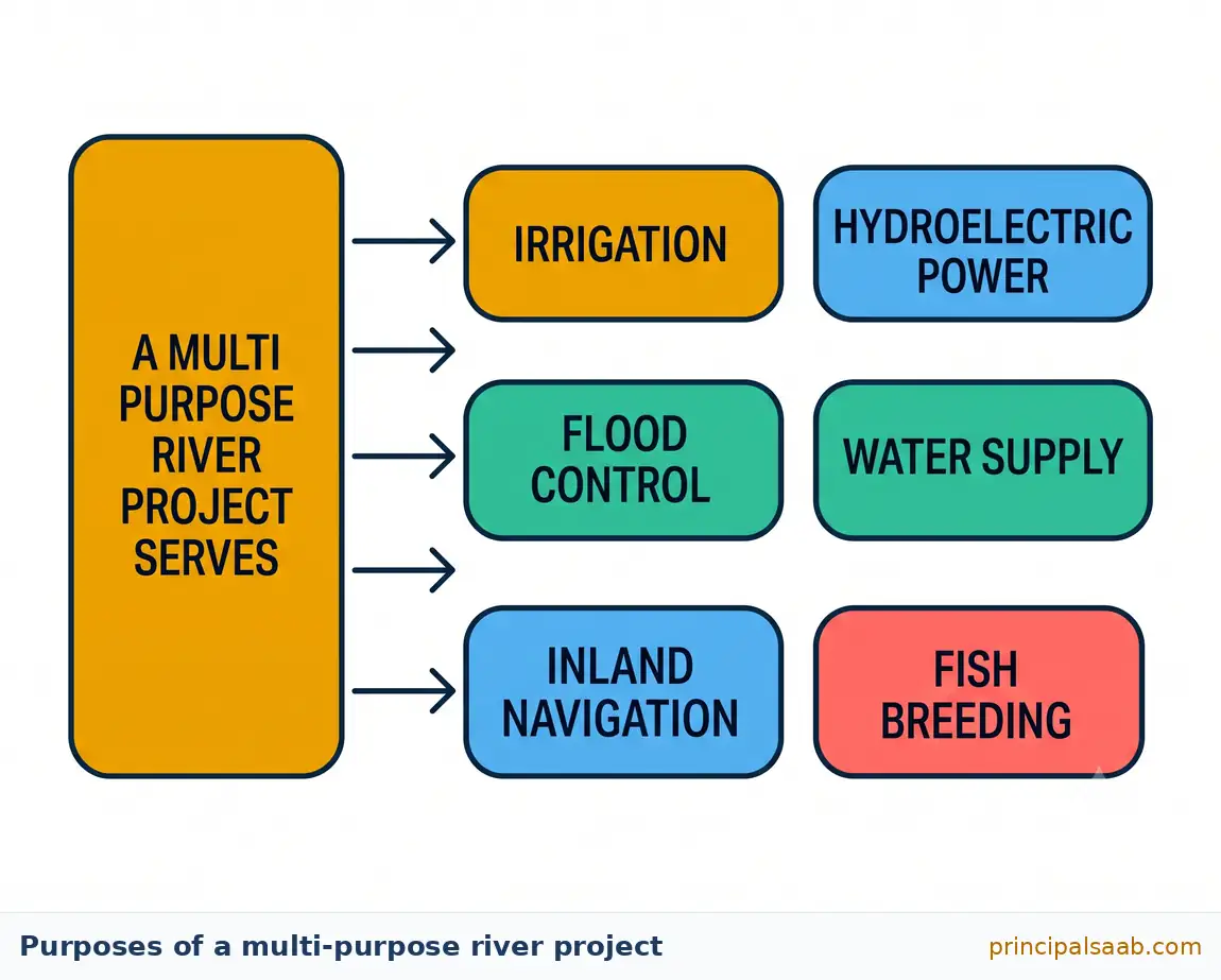
Now, the word “multi-purpose”. Early dams often did one job — usually storing water to irrigate fields nearby. A multi-purpose river project is designed so that the same structure and reservoir serve several different aims at once. This is not merely tidy; it is the economic argument that justifies the enormous cost. A wall that only irrigates must repay its cost from farming alone. A wall that irrigates, generates power, controls floods, supplies a city and supports fisheries can repay its cost from five directions.
Let us go through the purposes one by one, because a very common exam question simply asks you to list and explain them.
Irrigation. Usually the primary purpose. Stored water is released into a network of canals that carry it to fields, allowing farmers to grow crops in the dry season and to plant a second or even third crop in a year rather than waiting for the monsoon. This is what transformed agricultural output in the canal-served districts of Punjab, Haryana and western Uttar Pradesh.
Hydroelectric power generation. Water held high behind a dam carries energy simply by virtue of its height. Released through turbines at the base, it spins them and generates electricity. Hydropower has three attractions: it burns no fuel, so it produces no smoke or carbon dioxide at the point of generation; the “fuel” is free once the dam is built; and unlike solar or wind, output can be turned up within minutes to meet a sudden surge in demand, which makes it valuable for stabilising the grid.
Flood control. By absorbing a flood peak into empty reservoir space and letting it out slowly afterwards, a dam can protect towns and farmland downstream. The Damodar valley, once notorious for destructive floods in eastern India, is the classic example of a river system where a set of dams was built substantially with flood moderation in mind.
Water supply for domestic and industrial use. Reservoirs supply drinking water to cities and process water to factories, often through pipelines running many kilometres.
Inland navigation. Deepening and steadying the flow can make stretches of a river navigable for boats and barges, which is a cheap way to move heavy goods.
Fish breeding and aquaculture. The still water of a reservoir can support commercial fisheries, providing food and employment for local communities.
Recreation and tourism. Reservoirs become boating and picnic destinations, and some support wildlife sanctuaries around their margins, bringing visitors and income.
Soil conservation and afforestation. Catchment-area treatment programmes — planting trees and building small check structures upstream — are usually part of a project, and they reduce erosion into the reservoir.
The costs of a large dam — money, land, forest, displaced households — are paid once and paid heavily. Combining several benefits into a single structure is what makes those costs defensible in principle. It also explains a central tension you will meet shortly: the different purposes can pull against each other. Flood control wants the reservoir kept empty before the monsoon so it has room to absorb a flood; irrigation and power want it kept full so there is water to release later. The same reservoir cannot be both at once, and someone has to decide.
That last point is more than a curiosity — it is one of the most sophisticated things you can say about dams, and it explains real disasters. Hold on to it; we will come back to it when we discuss how dams can sometimes make flooding worse.
Example 7 — Warm-up (2 marks)
Question: What is a multi-purpose river project? Mention any two purposes it serves.
Model answer: A multi-purpose river project is a river valley scheme in which a single dam and its reservoir are planned and built to serve several objectives simultaneously, so that the heavy cost of the structure is justified by a range of benefits rather than by one alone. Two of its purposes are: (i) irrigation, in which stored water is carried through canals to fields, enabling cultivation in the dry season; and (ii) hydroelectric power generation, in which water released from the reservoir drives turbines to produce electricity without burning fuel.
Where the marks sit: One mark for a correct definition, one mark for two valid purposes. Notice that the definition contains the crucial word simultaneously — that is what makes it multi-purpose rather than simply a dam. When a question says “mention any two”, give exactly two and explain each briefly. Listing six purposes wastes time you need elsewhere and earns nothing extra.
Dams Through History and the Temples of Modern India
Dams are not a modern invention, and knowing that helps you write with confidence rather than reciting. People have been damming water for thousands of years. Archaeological evidence from ancient India shows sophisticated water engineering long before the modern era: stone embankments and reservoirs, irrigation tanks and canal systems built by successive kingdoms across the subcontinent. Communities in the semi-arid west built structures to trap the little rain they received, and hill communities built channels to guide stream water to terraced fields. The impulse to store and steer water is very old indeed.
What changed in the twentieth century was scale. Reinforced concrete, mechanised excavation, and modern engineering made it possible to throw a wall two hundred metres high across a major river and to flood hundreds of square kilometres behind it. A structure that once served a village could now serve several states. That change in scale is what created both the extraordinary benefits and the extraordinary controversies that this chapter is about.
Now to the phrase every student is expected to recognise. In the years after Independence, India faced a set of connected emergencies: recurring food shortages, very low electricity generation, destructive floods, and an economy that needed to industrialise quickly. Jawaharlal Nehru, the first Prime Minister, saw large river valley projects as the way to attack all of these at once — food through irrigation, industry through power, and safety through flood control. He described these projects as the “temples of modern India”.
It is worth pausing on why he chose that particular phrase, because examiners like students who can interpret it rather than merely quote it. A temple is where a community invests its collective resources in something larger than any individual. Calling a dam a temple placed science, engineering and national planning at the centre of the country’s hopes — it said, in effect, that the modern nation would be built by irrigating fields and lighting homes. It also carried real emotional weight for a country that had just become independent and wanted visible proof that self-rule could deliver.
These projects were also deliberately conceived as integrated development, not simply as engineering. The idea was that a dam would pull the surrounding region forward all together: canals would raise farm output, cheap power would attract industry, industry would create jobs, jobs would support towns, and towns would need schools and hospitals. That is the vision. Whether it was delivered evenly to everyone affected is precisely the argument of the next two sections.
Writing “Nehru called dams the temples of modern India” earns you recognition. Adding one sentence of interpretation — that the phrase reflected a post-Independence faith in science and planning as the route to food security, industry and national self-reliance — earns you the mark and marks you out as a strong candidate. Quotations are worth most when you show you understand why they were said.
Example 8 — Building up (3 marks)
Question: Why did Jawaharlal Nehru describe multi-purpose river projects as the “temples of modern India”? Explain.
Model answer:
- They were expected to solve several national problems at once. Newly independent India faced food shortages, very limited electricity and recurrent floods. Multi-purpose projects promised irrigation for food, hydroelectricity for industry and homes, and flood moderation for safety — all from a single investment.
- They symbolised faith in science, engineering and planned development. The phrase deliberately gave these structures the standing that temples held in Indian life, signalling that modern nation-building would rest on technology and collective national planning.
- They were intended to drive integrated regional development. Beyond the dam itself, canals, power supply, new industry, employment and improved transport were expected to lift the entire surrounding region, making the project a hub of overall progress rather than merely a water store.
Where the marks sit: Three distinct ideas — practical benefits, symbolic meaning, regional development. A weak answer only says “because they were very important for India”. Always convert an emotional claim into specific, nameable functions.
The Case FOR Multi-Purpose Projects
A warning before we begin, and it is a genuine one. Because the criticism of large dams is famous and dramatic, many students absorb only that side and write answers implying dams were a national mistake. That is not a balanced position, it is not historically fair, and it does not score well. An examiner reading a one-sided answer sees a student who has memorised a slogan. So let us build the case in favour properly and generously, exactly as its supporters would make it.
Food security and the transformation of agriculture. This is the strongest argument, and it should always come first. Before large-scale canal irrigation, a farmer in much of India planted once a year and prayed. A failed monsoon meant a failed harvest, and a failed harvest historically meant famine. Assured irrigation broke that link. It allowed multiple cropping, made high-yielding seed varieties viable — those varieties need reliable water to deliver their promise, so the Green Revolution simply could not have happened without irrigation — and turned a country that had to import food into one that feeds itself. Whatever else is true about dams, that achievement is real and it saved lives.
Electricity for development. Hydroelectric power lit villages, powered pumps, ran factories and made industrialisation possible in regions that had no coal of their own. It generates no smoke or carbon dioxide at the point of generation, which matters more now than it did then. And it is dispatchable — it can be ramped up in minutes when demand spikes on a hot evening, which is something no solar panel can do after sunset. As India adds more solar and wind, this flexibility becomes more valuable, not less.
Flood moderation. Reservoirs can absorb a flood peak and release it gradually, protecting downstream towns, farmland, roads and railways. Rivers that once inflicted regular devastation on eastern India were brought under a degree of control. Lives and property have unquestionably been saved.
Drinking water and industrial supply. Many Indian cities depend on reservoir water piped in from a dam. Without that stored supply, urban water availability in the dry months would be far worse than it is. Industry depends on the same assurance.
Employment and regional development. Construction itself employed very large numbers. Afterwards, canal irrigation supported agricultural employment, cheap power drew industry, and new towns, roads, markets and schools grew around the project. Regions that had been agriculturally marginal became productive.
Fisheries, navigation, recreation and tourism. Reservoirs support inland fisheries providing food and livelihood; some stretches become navigable; and reservoirs attract visitors and support wildlife sanctuaries, generating local income.
Water for the water-short. Canals from large projects carry water to genuinely dry regions far from the river itself, allowing cultivation and settled life where neither was previously secure. For a farmer in a semi-arid district, a canal is not an abstraction; it is the difference between a crop and no crop.
When a question asks you to “evaluate”, “examine”, “critically examine” or “discuss” multi-purpose projects, it is asking for both sides. A structured answer that gives roughly equal weight to benefits and criticisms, and then offers a short reasoned conclusion, scores higher than a passionate one-sided piece — even a well-written one. Balance is not fence-sitting here; it is the actual skill being examined.
Example 9 — Board level (5 marks)
Question: Describe any five advantages of multi-purpose river valley projects for India.
Model answer:
- Assured irrigation and food security. Canals fed by reservoirs supply water through the dry season, permitting multiple cropping and making high-yielding varieties viable. This underpinned the Green Revolution and helped India move from food shortage to self-sufficiency.
- Hydroelectric power. Water released through turbines generates electricity without burning fuel and without emissions at the point of generation, supplying homes, irrigation pumps and industry, and providing output that can be raised quickly when demand peaks.
- Flood control. Empty storage capacity absorbs the peak of a flood and releases it gradually, protecting downstream settlements, farmland and infrastructure from destruction.
- Domestic and industrial water supply. Reservoirs are piped to cities and industrial areas, providing an assured supply through the dry months when rivers run low.
- Employment and regional development. Construction, irrigated farming, fisheries, tourism and new industry attracted by cheap power generate employment, while roads, markets and towns develop around the project, lifting the wider region.
Where the marks sit: One mark per advantage. Each point names the benefit in bold and then explains the mechanism — how the dam produces it. “It gives electricity” is a statement; “water released through turbines generates electricity without burning fuel” is an explanation. Exams pay for explanations.
The Case AGAINST: Criticisms and Consequences
Now the other side, and I want you to read it with the same open mind you brought to the last section. None of what follows means the dams should never have been built. It means the costs were real, they fell on particular people, and a serious student acknowledges them.
Sedimentation and loss of storage
Rivers carry silt — fine soil and rock particles scoured from the land upstream. When the river enters the still water of a reservoir, it slows down and can no longer hold that load, so the silt settles on the reservoir floor. Year after year, the reservoir fills with mud from below, and its capacity to store water shrinks. Every dam has a design life partly determined by this, and heavy deforestation and soil erosion in the catchment speed the process up considerably.
The silt trapped behind the dam is also silt that no longer reaches downstream. Floodplains that were naturally fertilised by a thin annual layer of nutrient-rich silt stop receiving it, so farmers there must buy fertiliser to compensate. And deltas at the river mouth, which are built and maintained by deposited sediment, begin to erode and shrink as the sea takes back land the river no longer replenishes. The reservoir bed also becomes a breeding ground for aquatic vegetation and can accumulate contaminants.
Submergence of land, forests and habitat
A reservoir drowns everything behind the wall. That includes farmland, villages, forests, grazing land, temples, graveyards and archaeological sites. Large stretches of forest have been submerged by Indian reservoirs, taking with them the wildlife habitat and the biodiversity that depended on them. Vegetation rotting underwater in a new reservoir also releases greenhouse gases, which complicates the claim that hydropower is entirely emission-free.
There is a further effect on the river itself. A dam is a wall, and fish that migrate upstream to breed cannot climb it. Species that need to travel between the sea and upstream spawning grounds have declined sharply in dammed rivers. Below the dam, the river’s natural rhythm of high and low flows — the pattern aquatic life evolved around — is replaced by releases scheduled for irrigation demand or power generation.
Displacement and the problem of rehabilitation
This is the most serious human criticism and it deserves the most careful writing. Building a large reservoir requires people to leave their homes permanently. In India these displaced communities have been disproportionately tribal and rural, often people with a deep relationship to a specific landscape and, in many cases, without formal legal title to land their families had used for generations. Lacking documents, they were harder to compensate fairly, because compensation systems are built around paperwork.
Rehabilitation has frequently fallen short. Cash compensation is spent and gone; land offered in exchange has sometimes been of poorer quality, or far away, or already occupied. Beyond the material loss there is the loss of a way of life — a forest-dwelling community resettled onto a plain must learn entirely new livelihoods, and loses the social networks, sacred sites and shared resources that held it together. Displacement has frequently meant impoverishment.
And here is the deepest ethical objection, which you should be able to state in one clean sentence: the costs and the benefits fall on different people. The farmer whose land is irrigated, the city that gets its electricity and the industry that gets its power are usually far downstream. The family that lost its village is upstream. Even if the total benefit exceeds the total cost, that arithmetic does not by itself answer the question of whether it was fair to the people who paid.
Induced seismicity
A large reservoir places an enormous new weight on the earth’s crust, and water seeping into rock joints can alter the pressure within existing faults. Scientists have observed increases in small earth tremors in the vicinity of some large reservoirs, a phenomenon usually referred to as reservoir-induced seismicity. This is a particular concern for dams built in geologically young and active mountain zones such as the Himalaya, where the surrounding rock is already under stress. The scientific debate about how significant the effect is continues, so present it as a recognised concern rather than a settled certainty.
Changed flow regimes and downstream harm
Below a dam, the river runs on a schedule set by engineers rather than by the seasons. Reduced flow in the dry season concentrates pollutants that a fuller river would have diluted. Wetlands that depended on seasonal flooding dry out. Near the coast, a weakened river allows seawater to push further inland, turning previously fresh groundwater brackish and damaging farmland. Communities downstream who fished, farmed the floodplain or relied on the river’s rhythm can find their livelihoods altered without ever having been consulted.
The paradox: when dams make floods worse
This is the point that most impresses examiners, so let me make sure it is completely clear. Dams are built partly to control floods. Yet dams have sometimes caused or worsened floods. How?
Remember the conflict of purposes we noted earlier. To absorb a flood, a reservoir must have empty space waiting. But empty space is wasted water from the point of view of irrigation and power, so there is constant pressure to keep the reservoir as full as possible. If a reservoir is held near full when an unusually heavy spell of rain arrives, there is nowhere to put the water. Operators must then open the gates and release a very large volume quickly to protect the dam itself from being overtopped — and that sudden release, arriving on top of rain already falling downstream, can flood the plains harder and faster than the natural river would have done.
Two other mechanisms add to this. Sedimentation reduces the reservoir’s capacity over decades, so an old reservoir has less room to absorb a flood than it did when new. And the very existence of embankments and a reputation for flood safety encourages people to settle and build on floodplains that were previously left alone, so when a large flood does come, it finds far more property and people in its path.
That phrasing is too blunt and loses you the mark. The accurate statement is that dams can worsen flooding under particular conditions: when reservoirs are held near capacity and must make sudden large releases during heavy rain; when sedimentation has reduced their storage; and when a false sense of security encourages settlement on floodplains. Precision earns marks. Always name the condition under which the harm occurs.
Example 10 — Building up (3 marks)
Question: Explain how multi-purpose river projects, though built to control floods, have sometimes contributed to flooding.
Model answer:
- Sudden large releases from a full reservoir. Reservoirs are often kept near capacity to maximise irrigation and power output. When exceptionally heavy rain then arrives, there is no spare storage, and operators must release a very large volume at short notice to protect the dam. This surge, combined with rain already falling downstream, can flood the plains more severely than the natural river would have.
- Loss of storage capacity through sedimentation. Silt carried by the river settles on the reservoir bed year after year, steadily reducing the volume available to absorb a flood peak. An ageing reservoir therefore offers far less protection than it did when newly built.
- False sense of security on floodplains. Because the area is believed to be protected, settlement, farming and construction expand onto low-lying land that was previously avoided. When a flood exceeding the design capacity does occur, the damage to life and property is far greater than it would have been.
Where the marks sit: One mark per mechanism. This question rewards students who understand that the paradox has causes, not students who simply assert it. Each point explains a process, and each begins with a bolded label so the examiner can find the three separate ideas at a glance.
The Two Sides Side by Side
I promised you that benefits and criticisms stick better in pairs, so here they are in pairs. Each row sets a claimed benefit directly against the objection that sits opposite it. Learn this table row by row and you will never again write a one-sided answer.
| Theme | The Case FOR | The Case AGAINST |
|---|---|---|
| Agriculture | Assured canal irrigation allows multiple cropping and high-yielding varieties, underpinning food self-sufficiency. | Over-irrigation raises water tables and causes waterlogging and salinity; benefits often concentrate among larger landholders near canal heads. |
| Energy | Hydropower generates electricity without burning fuel and can be ramped up quickly to meet demand peaks. | Submerged vegetation decaying in reservoirs releases greenhouse gases, so the emissions benefit is smaller than often claimed. |
| Floods | Reservoir storage absorbs flood peaks and protects downstream towns, farmland and infrastructure. | Full reservoirs forced into sudden large releases can worsen floods; sedimentation erodes protective capacity over time. |
| People | Construction, irrigated farming, fisheries and new industry create large-scale employment and regional growth. | Large-scale displacement, disproportionately of tribal and rural communities, with rehabilitation that has often been inadequate. |
| Environment | Catchment afforestation and soil conservation programmes accompany projects; reservoirs support fisheries and sanctuaries. | Submergence of forest and habitat, blocked fish migration, altered flow regimes, and silt starvation of downstream floodplains and deltas. |
| Politics | Shared projects can formalise cooperation between states through agreed allocation of water and power. | Competing claims over stored water generate long-running inter-state and intra-state disputes. |
| Geology | Modern dams are engineered to withstand seismic loads specified for their zone. | The weight of large reservoirs is associated with increased local tremors, a concern in young mountain belts such as the Himalaya. |
The sharpest way to summarise the entire debate in one sentence for a conclusion: multi-purpose projects have generated substantial national benefits, but those benefits and their costs have been distributed unequally — the gains flow largely downstream to farmers, cities and industry, while the losses fall largely upstream on displaced communities and submerged ecosystems. Learn that sentence. It will finish a five-mark answer beautifully.
Movements and Disputes: Narmada Bachao Andolan and Water Conflicts
Because the costs of dams fall on identifiable people, those people have organised, argued and gone to court. And because rivers cross state boundaries, states have argued too. This section is about those arguments. Your job in an exam is not to pick a hero — it is to explain what each side wanted and why each position was reasonable from where they stood.
The Narmada Bachao Andolan
The Narmada flows westward across central India through Madhya Pradesh, along the Maharashtra border and into Gujarat, reaching the Arabian Sea. A large plan was drawn up to develop the river with a series of dams, of which the Sardar Sarovar Project in Gujarat is the best known and the largest.
The Narmada Bachao Andolan — literally the “Save the Narmada Movement” — emerged in the 1980s as a people’s movement opposing the scale of the project and, above all, the terms on which people were being displaced. It became one of the most significant environmental and social movements in independent India, and it fundamentally changed how large infrastructure projects in India are debated, assessed and challenged in court.
Now let me set out the positions of the different stakeholders, fairly, as each would state it themselves.
| Stakeholder | What they wanted and why |
|---|---|
| Displaced villagers, largely tribal communities | To keep their land, forests and villages, or at minimum to receive genuine land-for-land resettlement decided before submergence rather than after. Many had no formal title to land their families had used for generations, which made fair compensation difficult. They argued that people should not be asked to sacrifice their entire way of life for benefits delivered to strangers hundreds of kilometres away. |
| Environmental campaigners and activists | To halt or scale down the project, arguing that submergence of forest and habitat, sedimentation, and altered river flows were being understated, while the projected benefits were being overstated. They favoured smaller, decentralised alternatives such as local water harvesting, watershed development and check dams. |
| Farmers in water-short Gujarat and Rajasthan | To receive the canal water they had been promised. From their standpoint the project was not an abstraction but the prospect of reliable irrigation and drinking water in genuinely dry districts, and delay meant continued hardship for millions of people who were also poor. |
| State governments | To secure their allotted share of water and hydropower, and to complete a project seen as central to regional development. Different states along the river had different interests depending on whether they gained water or lost land. |
| The courts and central authorities | To weigh the developmental case against the rights of the displaced, and to link the raising of the dam height to the completion of rehabilitation obligations. Litigation continued over many years, and the project proceeded in stages under judicial supervision. |
What did the movement achieve? Even where construction went ahead, the Andolan changed the terms of the conversation permanently. Rehabilitation and resettlement became a subject of national debate and legal obligation rather than an administrative afterthought. Environmental clearance and public consultation became expected steps in planning large projects. And the idea that affected communities have a legitimate voice in decisions about their own displacement moved from the margins into mainstream Indian public life. That is a substantial legacy regardless of one’s view of the dam itself.
Inter-state and intra-state water disputes
Rivers do not respect state boundaries. When a river rises in one state and flows through two more, every drop stored upstream is a drop not available downstream. So states disagree, sometimes for decades. Understanding the shape of these disputes matters more than memorising every detail of any one of them.
The disputes over the Krishna and Godavari rivers involve several states of peninsular India, including Maharashtra, Karnataka, Telangana and Andhra Pradesh, disagreeing over how the rivers’ waters should be shared between them and over the storage and diversion each state may undertake. The Cauvery dispute, principally between Karnataka and Tamil Nadu, with Kerala and Puducherry also party to it, is among the longest-running water conflicts in India. Its structure is instructive: Karnataka lies upstream and wishes to store more water for its own irrigation and drinking needs; Tamil Nadu lies downstream and depends on releases arriving in time for its cropping season. Both states have farmers whose livelihoods genuinely depend on the outcome. Neither side is being unreasonable from where it sits.
Disputes also occur within a state. Farmers at the head of a canal may take more than their share, leaving those at the tail with little. Cities may claim reservoir water that farmers had been promised, since urban drinking water usually takes legal priority. Industry may compete with agriculture for the same source. These intra-state conflicts are less famous but affect enormous numbers of people daily.
India resolves inter-state river disputes through negotiation between states and, when that fails, through tribunals set up under the relevant central law, whose awards are binding. The process is often extremely slow, which is itself a criticism frequently made of it.
When you write about the Cauvery or Krishna–Godavari disputes, do not say one state is being unfair. Write the structure: “the upstream state seeks to store more water for its own irrigation, while the downstream state depends on timely releases for its cropping season, and both have farming populations whose livelihoods are genuinely at stake.” That sentence is safe, accurate, mature and complete. Examiners reward students who describe a conflict rather than joining it.
Example 11 — Board level (5 marks)
Question: What was the Narmada Bachao Andolan? Describe the concerns raised by the movement and its wider significance.
Model answer:
The Narmada Bachao Andolan, meaning “Save the Narmada Movement”, was a people’s movement that emerged in the 1980s opposing the scale and terms of the large dam projects planned on the Narmada river, of which the Sardar Sarovar Project in Gujarat is the largest.
- Displacement of communities. The reservoirs would submerge villages and farmland, displacing large numbers of people, a disproportionate share of them tribal communities with a long-standing relationship to the land and forests.
- Inadequate rehabilitation. The movement argued that resettlement arrangements were insufficient and poorly implemented, that many affected families lacked formal land title and were therefore hard to compensate, and that cash payments could not replace a lost livelihood and community.
- Environmental damage. Campaigners pointed to the submergence of forest and wildlife habitat, the trapping of silt behind the dam, and the alteration of the river’s natural flow downstream.
- Questioning the distribution of benefits. They argued that the gains — irrigation and power — would flow to distant regions while the costs fell on those living at the site, and advocated smaller, decentralised alternatives such as local water harvesting and watershed development.
- Wider significance. Although construction proceeded in stages under judicial supervision, the movement permanently changed public debate in India, making rehabilitation, environmental clearance and consultation with affected communities expected parts of planning large projects.
Where the marks sit: One mark for identifying the movement and four for its concerns and significance. Observe that the answer states the opposing view fairly — it notes that construction continued and that water-short regions expected genuine benefit. That fairness is a strength, not a weakness.
Map Skill: Locating India’s Major Dams
Right — this is the section you were worried about, and I want to begin by shrinking the problem down to its true size. There are eight dams. Not eighty. Eight. You have almost certainly memorised longer lists than this without noticing — the eleven players in a cricket eleven, the songs on an album, the names of your whole extended family. Eight is completely manageable. What makes it feel hard is trying to memorise eight names in a vacuum. What makes it easy is attaching each name to a river and a place, so that each one becomes a small story instead of a floating word.
For the CBSE Class X Social Science curriculum for 2026-27, the map-work requirement from this chapter is to locate and label these eight dams on a political outline map of India: Salal, Sardar Sarovar, Bhakra Nangal, Hirakud, Tehri, Nagarjuna Sagar, Rana Pratap Sagar and Tungabhadra. Geography contributes 3 marks of map pointing to the paper. Those are among the most reliably earnable marks in the whole subject, because unlike an essay there is no ambiguity about what is being asked. Get the location right and the mark is yours.
Study the table below until you can cover the second and third columns and recite them from the first.
| Dam | River | State | How to find it on a blank map |
|---|---|---|---|
| Salal | Chenab | Jammu and Kashmir | The northernmost dam on your list. Go to the very top of the map, into Jammu and Kashmir (Reasi district). If your mark is the highest one on the page, you are in the right area. |
| Bhakra Nangal | Satluj | Himachal Pradesh | Below Jammu and Kashmir, in southern Himachal Pradesh (Bilaspur district), close to the Punjab boundary. Its reservoir is Gobind Sagar. The Nangal barrage lies just downstream in Punjab, so mark near the HP–Punjab border. |
| Tehri | Bhagirathi | Uttarakhand | East of Himachal, in the Garhwal hills of Uttarakhand. Among India’s tallest dams. Remember it sits on a headstream of the Ganga, high in the mountains, not on the plains. |
| Rana Pratap Sagar | Chambal | Rajasthan | South-eastern Rajasthan, at Rawatbhata in Chittorgarh district. Look for the Chambal in the south-east corner of Rajasthan, well away from the desert in the west. |
| Sardar Sarovar | Narmada | Gujarat | Eastern Gujarat, on the Narmada near Kevadia in Narmada district, close to the Madhya Pradesh boundary. The Narmada is the big west-flowing river across central India. |
| Hirakud | Mahanadi | Odisha | Western Odisha, near Sambalpur, on the east side of the country. One of the world’s longest dams. If you have marked it on the west coast, you have gone the wrong way. |
| Nagarjuna Sagar | Krishna | Telangana / Andhra Pradesh border | On the Krishna where Telangana meets Andhra Pradesh (Nalgonda district in Telangana, Palnadu district in Andhra Pradesh). Mark it on the Krishna at that border, in the eastern Deccan. |
| Tungabhadra | Tungabhadra (a tributary of the Krishna) | Karnataka | Northern Karnataka, near Hosapete (Hospet) in the Vijayanagara–Ballari area. It lies south-west of Nagarjuna Sagar, upstream in the Krishna system. |
Memory hooks that actually work
Now let me give you the tricks. These are not clever for their own sake — each one attaches a name to something your memory already holds firmly.
- Salal sits on the Chenab. Both words are short, both belong to the far north. Say “Salal–Chenab” as a single word a few times, the way you would a friend’s full name. Two “a” sounds, top of the map.
- Bhakra goes with Satluj, and Satluj goes with Punjab’s five rivers. You already know Punjab is the land of five rivers, and the Satluj is one of them. Bhakra is the great dam of that system. Bonus link: its reservoir is Gobind Sagar, and Bhakra Nangal is the name that made canal irrigation famous in north-west India.
- Tehri and Bhagirathi both belong to the Ganga’s mountain childhood. The Bhagirathi is a headstream of the Ganga. Tehri is very tall and very high up. Link the idea “tallest, highest, youngest part of the Ganga” and Tehri falls into place.
- Rana Pratap was a king of Mewar in Rajasthan — so Rana Pratap Sagar is in Rajasthan. This one is a gift. The name tells you the state. And the river is the Chambal, which is the Rajasthan river you know from your History and Geography reading. Never get this one wrong again.
- Sardar Sarovar sits on the Narmada — and the Narmada Bachao Andolan is about exactly this dam. You have just read a whole section about it, so the link is already made. Sardar Patel was from Gujarat; Sardar Sarovar is in Gujarat.
- Hirakud is on the Mahanadi in Odisha. “Maha-nadi” means great river, and it is the great river of Odisha. Hirakud is famously one of the longest dams in the world — long dam, long river name, eastern coast.
- Nagarjuna Sagar and Tungabhadra are both in the Krishna family. Nagarjuna Sagar is on the Krishna itself; Tungabhadra is on the Tungabhadra, which joins the Krishna. Learn them as a pair: Tungabhadra upstream in Karnataka, Nagarjuna Sagar downstream at the Telangana–Andhra border. Two dams, one river system, west to east.
Here is a second organising idea that many students find even more useful than individual hooks: sort the eight by direction. Three are northern mountain dams (Salal, Bhakra Nangal, Tehri, running west to east along the Himalaya). Two are in the west and centre (Rana Pratap Sagar in Rajasthan, Sardar Sarovar in Gujarat). One is in the east (Hirakud in Odisha). Two are in the southern Deccan on the Krishna system (Tungabhadra in Karnataka, Nagarjuna Sagar at the Telangana–Andhra border). Three, two, one, two. Say it as a rhythm. When you sit in the exam and see a blank map, you will recall the rhythm first and the names will follow.
These are the swaps that cost marks every single year, so read them slowly:
• Putting Tehri on the Ganga instead of the Bhagirathi. The Bhagirathi is a headstream of the Ganga, but the dam is on the Bhagirathi — say Bhagirathi.
• Putting Bhakra Nangal on the Beas or the Ravi. It is on the Satluj.
• Confusing Nagarjuna Sagar and Tungabhadra. Nagarjuna Sagar is on the Krishna; Tungabhadra is on the Tungabhadra, a tributary that joins the Krishna.
• Placing Hirakud on the west coast. It is in Odisha, on the eastern side, on the Mahanadi.
• Putting Sardar Sarovar in Madhya Pradesh. The Narmada does flow through Madhya Pradesh, but the Sardar Sarovar dam itself is in Gujarat, near the MP boundary.
• Placing Rana Pratap Sagar in western Rajasthan. It is in the south-east of the state, on the Chambal.
1. Use a sharp pencil and make a small, clear dot or a small triangle, not a large blob that covers three states.
2. Write the name neatly beside the mark with a short line connecting them if there is any doubt.
3. Spell the name correctly — a badly misspelt label can cost the mark.
4. Do the map question first if it is on a separate sheet, while your hand is steady and you are not rushing.
5. If the paper offers you the option to answer map items in writing instead (for candidates permitted to do so), state the dam, its river and its state in a single clean sentence.
6. Practise on a real blank outline map at least four separate times before the exam. Reading this table is preparation; marking the map is practice. They are not the same thing.
Example 12 — Map identification walk-through (1 mark)
Question: On the given political outline map of India, a dam is marked as A in the northern part of the country, on a river in Jammu and Kashmir. Identify it and name the river.
How to work it out, step by step:
- Locate the region first, not the name. The marking is in Jammu and Kashmir. Run through your list of eight and ask which one lives there. Only one does.
- Check against the north-to-south rhythm. Your northern trio is Salal, Bhakra Nangal and Tehri, running west to east. Bhakra Nangal is in Himachal Pradesh and Tehri is in Uttarakhand — both further south. That leaves Salal.
- Recall the paired name. Salal–Chenab. The river is the Chenab.
Model answer: A is the Salal dam, built on the Chenab river in Jammu and Kashmir.
Note the method: you did not try to remember the answer directly. You narrowed by region, eliminated, then retrieved the pair. That is a technique that works even when you are nervous, because elimination is easier than recall.
Example 13 — Map identification walk-through (2 marks)
Question: Two dams are marked on the outline map of India: P in northern Karnataka, and Q on the Krishna river where Telangana meets Andhra Pradesh. Identify both and name the river each is built on.
How to work it out, step by step:
- Recognise that both belong to the Krishna family. Your southern pair is Tungabhadra and Nagarjuna Sagar, and the rule you learned is: Tungabhadra upstream in Karnataka, Nagarjuna Sagar downstream at the Telangana–Andhra border.
- Match by position. P is in northern Karnataka, so P is Tungabhadra. Q is further east on the Krishna at the state boundary, so Q is Nagarjuna Sagar.
- Name the rivers separately and carefully. This is where students slip. Tungabhadra dam is on the Tungabhadra river, which is a tributary of the Krishna. Nagarjuna Sagar is on the Krishna itself.
Model answer: P is the Tungabhadra dam in Karnataka, built on the Tungabhadra river, a tributary of the Krishna. Q is the Nagarjuna Sagar dam on the Krishna river, located where Telangana meets Andhra Pradesh.
Where the marks sit: One mark per dam correctly identified with its river. Writing “both are on the Krishna” would lose you a mark, because the Tungabhadra dam is on the tributary and not on the main river. Precision about tributaries matters.
Example 14 — Recall drill (3 marks)
Question: Name the river and the state associated with each of the following dams: (i) Hirakud (ii) Sardar Sarovar (iii) Rana Pratap Sagar.
Model answer:
- Hirakud — built on the Mahanadi river in Odisha, near Sambalpur.
- Sardar Sarovar — built on the Narmada river in Gujarat, close to the Madhya Pradesh boundary.
- Rana Pratap Sagar — built on the Chambal river in Rajasthan, at Rawatbhata in the south-east of the state.
Where the marks sit: One mark for each complete dam–river–state triple. Give all three parts even when the question only asks for two; the extra detail costs you four words and protects you if the examiner expects it. Do this drill from memory once a week and it will become automatic.
Before you leave this section, do one thing for me. Close this page, take a blank sheet, and write the eight dams down the left with their rivers and states beside them. Whatever you miss, come back and re-read only those rows. That takes four minutes and is worth more than another hour of reading.
Rainwater Harvesting: Traditional Indian Systems
We have spent a long time on big walls across big rivers. Now we turn to the opposite idea, and it is one of the most satisfying parts of this chapter: catching the rain exactly where it falls, before it goes anywhere at all.
Rainwater harvesting means collecting rainwater where it falls — on a roof, on a field, on a hillside, in a village catchment — and either storing it for later use or letting it soak into the ground to recharge the water below. That is the whole concept. It is beautifully simple, requires no displacement of anyone, floods nothing, and can be built by a household or a village without waiting for a government.
And here is the part that genuinely deserves your admiration. Long before anyone in India had a concrete mixer or an engineering degree, communities across the subcontinent had worked out how to do this — and had adapted the method precisely to their own climate, geology and crops. A technique that works in the Rajasthan desert would be pointless in Meghalaya, and the villagers of both places knew it. These are not quaint old customs. They are locally optimised engineering, refined over centuries, and in several places they are being revived today because they work.
Let me take you through them region by region, because that is how they will stay in your memory.
The semi-arid west: Rajasthan and Gujarat
In a land where rain is scarce, unpredictable and evaporates fast, every technique is about capturing a brief downpour and hiding the water from the sun.
Khadins are an ingenious system from the Jaisalmer region. A long earthen embankment, or bund, is built across the lower slope of a rocky catchment. When it rains, water runs off the hard rock surface and collects behind the bund, soaking deeply into the soil there. The water is not stored to drink — it is stored inside the soil, and crops are then sown on that moist land after the water recedes. The field itself is the reservoir. It is a way of farming a desert using the rock as a collecting surface.
Johads are small earthen check dams built across a slope or a seasonal stream to catch and hold run-off. Water gathers in the depression behind the bund and slowly percolates downward, recharging the groundwater and lifting the level in nearby wells. A johad is essentially a small pond with a serious job: it is less about the water you can see and more about the water it quietly pushes underground. Johad revival programmes in parts of Rajasthan have brought dry wells and even seasonal streams back to life.
Tankas are the drinking-water solution, and they are remarkable. In the arid districts of Rajasthan — Bikaner, Phalodi and Barmer among them — households built underground covered tanks, cylindrical or rectangular, dug beneath the courtyard or the main room of the house. Rain falling on the rooftops and on the specially prepared courtyard flowed down through pipes and channels into this tank. Being underground and covered, the water stayed cool, lost very little to evaporation and kept for a long time — sometimes right through the dry season and beyond. Families depended on tanka water for drinking, since it was cleaner and better tasting than what a well in that region could offer.
There is a lovely detail worth remembering: in these households the very first rain of the season was often not collected. It was allowed to run off, because it would carry the dust and dirt accumulated on the roof and courtyard through the long dry months. Only the water that came afterwards, over clean surfaces, was let into the tank. That is a sophisticated understanding of water quality, arrived at without a laboratory.
These two get swapped constantly in exams, so fix the difference now with one contrast:
• A tanka is an underground covered tank, usually beneath a house or courtyard, fed by rooftop and courtyard run-off, built to store clean drinking water for a family.
• A johad is an open earthen check dam or small pond built across a slope, built mainly to let water percolate into the ground and recharge wells for the community.
Remember it as: tanka = under the house, for drinking; johad = out in the open, for the groundwater. One is private and roofed, one is communal and open.
The Western Himalayas: guls and kuls
In the hill regions of the western Himalaya — Himachal Pradesh, Jammu and Kashmir, and Uttarakhand — the problem is not that water is absent. Streams fed by rain and snowmelt are plentiful. The problem is that the water is in the valley bottom and the fields are on the terraced slopes above. Water will not climb.
The solution is guls and kuls: channels diverted from a stream high up the mountain and carried along the contour of the hillside at a very gentle gradient, sometimes for kilometres, until they arrive above the terraced fields and can be released downhill onto them. Building one requires real skill — the slope must be shallow enough that the water does not rush and erode the channel, yet steep enough that it keeps flowing. Villages traditionally maintained these channels collectively and shared the water by an agreed rota.
The north-east: bamboo drip irrigation in Meghalaya
This is my favourite, and I suspect it will be yours. Meghalaya is among the wettest places on Earth. So why would anyone there need an irrigation technique? Because the crops grown on those steep, rocky hillsides — betel leaf, black pepper, areca nut — are planted where there is very little soil, and water poured on such a slope simply runs off, taking the thin soil with it. What the plants need is a small, steady, continuous supply delivered right at the root.
The tribal communities of Meghalaya solved this with bamboo. Water from a hillside spring or stream is tapped and carried down the slope through a network of bamboo pipes, split and jointed, running for long distances and dividing again and again into progressively smaller channels. At the far end, the flow has been reduced to a slow drip delivered to the base of an individual plant. It is drip irrigation, achieved entirely with bamboo, developed centuries before anyone marketed a plastic drip kit. Almost no water is wasted, and no soil is washed away.
Also in the north-east, rooftop rainwater harvesting is common in Shillong, the capital of Meghalaya. This produces one of the sharpest ironies in the whole chapter, and it is a favourite of examiners: Shillong lies close to Cherrapunji and Mawsynram, among the rainiest places on the planet, and yet the town has faced genuine shortages of piped drinking water. Households therefore harvest rain from their own roofs to meet a large share of their needs. If you ever need to prove in one sentence that scarcity is about storage, access and infrastructure rather than rainfall alone, Shillong is your evidence.
Elsewhere: tanks, ponds and flood-water channels
Across the plains and the peninsula, communities dug and maintained tanks, ponds and lakes to store monsoon run-off for irrigation, livestock and domestic use, particularly in the Deccan where hard rock made wells difficult. In the flood plains of West Bengal, inundation channels were traditionally used to lead flood water onto fields, spreading both water and fertile silt. In arid regions, run-off from rooftops and courtyards was routinely directed into household or communal storage. The common principle everywhere is the same: match the technique to the local rainfall, rock and crop.
| System | Region | What it is and what it does |
|---|---|---|
| Khadins | Jaisalmer, Rajasthan | Earthen bunds across a rocky slope trap run-off so it soaks into the soil behind them. Crops are then grown on the moist land — the field itself acts as the store. |
| Johads | Rajasthan and neighbouring semi-arid areas | Small open earthen check dams that hold run-off in a depression, allowing it to percolate downward and recharge groundwater and nearby wells. |
| Tankas | Bikaner, Phalodi, Barmer and other arid districts of Rajasthan | Underground covered tanks beneath courtyards or rooms, fed by rooftop and courtyard run-off, storing cool clean drinking water with minimal evaporation loss. |
| Guls and kuls | Western Himalayas — Himachal Pradesh, Jammu and Kashmir, Uttarakhand | Contour channels that divert stream and snowmelt water along a hillside at a gentle gradient to reach terraced fields that lie above the valley floor. |
| Bamboo drip irrigation | Meghalaya, north-east India | Networks of split bamboo pipes carry spring water down steep slopes, dividing repeatedly until it reaches individual plants as a slow drip — minimising both water loss and soil erosion. |
| Rooftop harvesting | Shillong, Meghalaya, and widely across India | Rain collected from roofs through gutters and pipes into tanks or recharge pits. Common in Shillong despite the region’s very high rainfall, because piped supply is limited. |
| Tanks and ponds | Deccan plateau and peninsular India | Community-built and maintained storage for monsoon run-off, used for irrigation, livestock and domestic needs where hard rock limits well digging. |
| Inundation channels | Flood plains of West Bengal | Channels that lead flood water onto agricultural fields, delivering both irrigation and a deposit of fertile silt. |
Each of these techniques answers a specific local question. Rajasthan’s designs fight evaporation and store for a long dry season. Himalayan designs solve the problem of moving water sideways across a slope. Meghalaya’s bamboo pipes deliver tiny quantities precisely, on ground too steep and thin-soiled for flooding. If an exam asks why traditional systems remain relevant, the strongest answer is that they are decentralised, low-cost, community-managed, well suited to local conditions, and they displace nobody.
Example 15 — Warm-up (2 marks)
Question: What are tankas? Why were they built underground?
Model answer: Tankas are underground covered tanks, usually built beneath the courtyard or main room of a house in the arid districts of Rajasthan such as Bikaner, Phalodi and Barmer. Rainwater falling on rooftops and prepared courtyards was channelled into them and stored for drinking. They were built underground and kept covered because in a hot desert climate water stored in the open evaporates rapidly; below ground it remains cool, loses very little to evaporation, stays protected from dust and contamination, and therefore keeps well through the long dry season.
Where the marks sit: One mark for describing what a tanka is and where it is found, one mark for the reason. Notice the question has two parts — “what” and “why” — and the answer visibly addresses both. Whenever a question contains two question words, make sure your answer has two distinct halves.
Example 16 — Building up (3 marks)
Question: Describe the bamboo drip irrigation system of Meghalaya and explain why it suits the conditions of that region.
Model answer:
- What it is. Water from a hillside spring or stream is tapped and carried down the slope through a network of split bamboo pipes. The network divides repeatedly into smaller and smaller channels so that, by the time the water reaches its destination, it arrives as a slow drip at the base of an individual plant.
- Why the terrain demands it. The crops grown there — betel leaf, black pepper and areca nut — are cultivated on steep, rocky hillsides with a very thin layer of soil. Applying water in bulk on such a slope would simply run off and carry the soil away with it, so a slow, targeted delivery is the only method that works.
- Why it is efficient. Because water is delivered directly to the root in small quantities, almost none is lost to run-off or evaporation, and erosion is prevented. The materials are locally available and cost nothing to obtain, and the system can be built and repaired by the community itself.
Where the marks sit: One mark for the description, one for linking it to the terrain and crops, one for the efficiency argument. The trap in this question is answering only “what it is”. Whenever a question adds “and explain why”, roughly two-thirds of the marks live in the “why”.
Modern Rooftop Harvesting and Community Success Stories
Traditional systems are inspiring, but you might reasonably ask whether any of this belongs in the present. It does — and the modern versions are among the few genuinely good-news stories in this chapter.
Modern rooftop rainwater harvesting is the same old idea with better plumbing. Rain falling on a roof is collected by gutters and carried down a pipe. Before it is stored, it passes through a first-flush device that diverts the initial dirty run-off — remember the desert households doing exactly this by hand — and then through a simple filter of gravel, sand and charcoal. From there it goes one of two ways. It can be stored in a tank for direct use, or it can be led into a recharge pit or recharge well, where it soaks into the ground and refills the aquifer beneath the building.
That second option deserves a moment of thought, because it is the more powerful one in cities. Recharging groundwater turns the earth itself into your storage tank: it costs nothing to build, never evaporates, needs no maintenance and cannot leak. You are effectively banking water underground and withdrawing it later through a well. In dense urban areas where nobody has room for a large tank, recharge is often the only realistic option — and it is exactly what a paved city has stopped doing naturally.
The benefits stack up in a way that few interventions manage. Rooftop harvesting reduces the load on the municipal supply. It raises the local water table, so nearby wells and borewells last longer. In coastal areas the freshwater pushing downward helps hold back seawater intrusion. It reduces street flooding during heavy rain, because water that soaks in is water not running into an overwhelmed drain. And rainwater is naturally soft and free of the dissolved salts that make hard groundwater unpleasant for washing. All of that from a pipe, a filter and a pit.
Two success stories worth knowing
A village that made itself water-rich: the Gendathur case. Gendathur is a village in the Mysuru district of Karnataka that became widely known as a rainwater-harvesting success story. Villagers installed rooftop rainwater harvesting systems on their houses, with roughly two hundred households taking part. Given the village’s annual rainfall of about a thousand millimetres, and allowing for realistic collection efficiency, an ordinary house roof there can capture and use a very substantial quantity of water each year — commonly cited estimates run to the order of tens of thousands of litres per household annually. The village consequently earned a reputation for being unusually rich in rainwater despite being a modest rural settlement.
The lesson to draw from Gendathur is not the arithmetic. It is that no dam was built, nobody was displaced, no forest was submerged, no state government had to negotiate with another, and the community solved its own problem using a resource that was already falling on its own roofs. In an exam answer about alternatives to large projects, that contrast is your strongest point.
A state that made it law: Tamil Nadu. After a run of severe drought years in the early 2000s that left Chennai in acute water distress, the Government of Tamil Nadu acted decisively. Through an ordinance issued in July 2003, it made rainwater harvesting structures compulsory for all buildings in the state, both public and private, with a short deadline for compliance. Building plan approvals and new water and sewer connections were tied to having a harvesting structure in place, and there were legal provisions for penalising defaulters. Tamil Nadu is widely described as the first Indian state to have made rooftop rainwater harvesting compulsory for all buildings across the state.
It is worth being honest about the outcome, because honesty scores well. The measure led to a very large number of structures being built and is credited with helping groundwater levels in Chennai. It also did not make the city permanently immune to water crises — Chennai has faced severe shortages since. The mature conclusion, and a good closing line for an answer, is that rainwater harvesting is a powerful and necessary part of the solution, but it works best when it is genuinely maintained and combined with reduced waste, treated wastewater reuse and better distribution.
If you remember one specific thing about modern harvesting, make it this: Tamil Nadu was the first Indian state to make rooftop rainwater harvesting compulsory for all buildings, through an ordinance in 2003. It is short, precise, frequently asked, and it fits into almost any answer about conservation measures. Pair it with Gendathur, Karnataka as the village-level example and you have both a policy case and a community case ready to deploy.
Example 17 — Building up (3 marks)
Question: Explain three benefits of rooftop rainwater harvesting in urban areas.
Model answer:
- It reduces pressure on the municipal supply. Water collected from a building’s own roof can meet part of its washing, cleaning and flushing needs, so less has to be drawn from distant reservoirs and pumped across the city.
- It recharges depleted groundwater. Where run-off is directed into recharge pits and wells, it soaks into the aquifer beneath the building, raising the water table, prolonging the life of local borewells, and in coastal cities helping to resist the inward movement of saline seawater.
- It reduces urban flooding and provides good-quality water. Rain that soaks into the ground does not run into already overloaded storm drains, so streets flood less during heavy downpours. Harvested rainwater is also naturally soft and free of the dissolved salts found in hard groundwater, making it well suited to domestic use.
Where the marks sit: One mark per benefit. The strongest of the three is groundwater recharge — mention it in every answer on this topic. Adding “in coastal cities it helps resist seawater intrusion” is the kind of specific detail that signals a well-prepared candidate.
Example 18 — Case study (4 marks)
Read the following passage and answer the questions that follow.
Ramnagar is a town of about forty thousand people on the bank of a large perennial river. Rainfall is generous — around 1,200 millimetres a year — and the river flows all year round. Yet residents complain constantly about water. The municipal pipeline reaches most colonies for only ninety minutes on alternate days. Two settlements on the eastern edge have no connection at all and buy from private tankers at a price several times the municipal rate. The river itself receives untreated sewage from the town and effluent from a cluster of dyeing units upstream, and the water below the town has turned dark and lost most of its fish. Over the last fifteen years the town has expanded rapidly; open ground and small fields have been replaced by concrete roads, rooftops and parking areas, and the older wells in the central bazaar have gone dry. During the monsoon, the main market floods within twenty minutes of a heavy shower.
(i) Ramnagar has both high rainfall and a perennial river. Explain why its residents still face water scarcity. (2 marks)
Scarcity here is a problem of quality and access rather than of quantity. First, the river’s water has been made unusable: untreated town sewage and effluent from the dyeing units have so degraded it that it can no longer serve as a source of drinking water, and its aquatic life has largely died. Second, delivery is inadequate and unequal — the piped supply runs for only ninety minutes on alternate days, and two settlements have no connection at all and must buy from tankers at several times the municipal rate. Water is physically abundant in Ramnagar; it is simply neither clean enough nor fairly distributed.
(ii) The wells in the central bazaar have gone dry while the market floods within twenty minutes of heavy rain. Explain the connection between these two facts. (1 mark)
Both result from the same cause: the paving over of open ground during the town’s rapid expansion. Where rain once soaked slowly into soil and fields and percolated down to recharge the aquifer, it now strikes concrete roads, rooftops and parking areas and runs off immediately into drains. Recharge has therefore stopped, causing the water table to fall and the bazaar wells to dry, while the sudden concentrated run-off overwhelms the drainage system and floods the market. The same rain is lost twice over.
(iii) Suggest one measure the municipality could take that would address both problems at once, and justify your choice. (1 mark)
The municipality should make rooftop rainwater harvesting with recharge pits compulsory for buildings, as Tamil Nadu did by ordinance in 2003. Directing roof run-off into recharge pits would return water to the aquifer, gradually raising the water table and reviving the bazaar wells, while simultaneously diverting run-off away from the storm drains and reducing flooding in the market. A single low-cost measure therefore treats both the dry wells and the flooding, because both arise from the same underlying loss of infiltration.
How to attack a case study: underline the clues in the passage before you write — here they are “untreated sewage”, “ninety minutes on alternate days”, “no connection at all”, “concrete roads”, “wells gone dry”, “floods within twenty minutes”. Every one of those phrases was placed there deliberately for you to use. A case study is not testing new knowledge; it is testing whether you can apply what you already know to the specific evidence in front of you. Always quote details from the passage back into your answer.
Sustainable Water Management: What a Balanced Answer Looks Like
We are nearly at the end of the teaching, and this last section is where everything joins up. It also happens to be where the highest-scoring answers come from, because it asks you to be sensible rather than dramatic.
Some students finish this chapter having concluded that large dams are bad and rainwater harvesting is good, and they write that in the exam. It is a tempting conclusion and it is not a very good one. Consider: rooftop harvesting cannot generate electricity for a steel plant. A johad cannot irrigate a canal command of hundreds of thousands of hectares. No arrangement of village ponds could have delivered the food security that canal irrigation delivered to north-west India. Small-scale methods are excellent at what they do, but what they do is not everything.
Equally, large projects cannot solve the problems that harvesting solves. A dam three hundred kilometres away does nothing for the water table under a city. It does not stop a bazaar from flooding. It cannot reach a hamlet with no pipeline. And it comes with costs — displacement, submergence, sedimentation, disputes — that a recharge pit simply does not have.
Large multi-purpose projects and small decentralised systems are complementary, not rival. India needs large storage for regional irrigation, hydropower and flood moderation, and it needs widespread local harvesting and recharge for household supply, groundwater renewal and urban resilience. The real questions are not “dam or no dam” but: are projects planned with honest assessment of environmental and social costs, is rehabilitation of displaced people completed properly and in advance, and is water used efficiently once it has been delivered?
So what does sustainable water management actually consist of? Here is the working list, which doubles as an answer plan for any question that asks how India should manage its water.
- Use less for the same output. Irrigation is the largest user by far, so the largest savings are there. Drip and sprinkler systems deliver water to the root instead of flooding the field, cutting waste dramatically. Levelling fields, lining canals to stop seepage, and choosing crops suited to local rainfall rather than water-hungry crops in dry districts all pull in the same direction.
- Harvest and recharge everywhere. Rooftop systems, recharge pits, revived johads and tanks, check dams and watershed development across a catchment. This is cheap, fast, and it works from the bottom up without waiting for a large project.
- Treat and reuse wastewater. Water used for washing and cooling can be treated and reused for irrigation, industrial cooling, flushing and landscaping. This directly increases usable supply and simultaneously reduces pollution.
- Fix the leaks. A meaningful share of municipal water is lost from ageing pipes before it reaches anyone. Repairing distribution networks is unglamorous and among the cheapest water anyone can find.
- Control pollution at source. Enforce effluent treatment for industry and expand sewage treatment for towns. Every litre kept clean is a litre added to supply.
- Regulate groundwater as a shared resource. Because aquifers are common property, individual restraint fails without collective rules. Community-managed extraction limits, mandatory recharge, and rational pricing of the electricity used for pumping all help.
- Involve local communities in decisions. Systems maintained by the people who depend on them survive; systems imposed from outside frequently do not. This applies equally to a village tank and to the rehabilitation plan for a large dam.
- Protect ecological flows. Leave enough water in the river for the river itself, so that aquatic life, silt transport and coastal deltas survive.
Example 19 — Board level (5 marks)
Question: “Rainwater harvesting is a better alternative to large multi-purpose projects.” Do you agree? Give arguments in support of your view.
Model answer:
I agree only in part. Rainwater harvesting has real advantages over large projects, but it cannot replace them entirely, and the two are better understood as complementary.
Arguments supporting rainwater harvesting:
- It displaces nobody and submerges nothing. Unlike a large reservoir, harvesting requires no acquisition of land, no flooding of villages or forests, and no rehabilitation of communities.
- It is low-cost and decentralised. A household or village can build and maintain a system without waiting for large public investment, as villagers in Gendathur in Karnataka’s Mysuru district demonstrated by installing rooftop systems across roughly two hundred households.
- It recharges groundwater directly where water is needed. Recharge pits raise the local water table, revive nearby wells, resist seawater intrusion in coastal areas and reduce urban flooding — none of which a distant reservoir can do.
Arguments for retaining large projects:
- Scale of irrigation and power. Only large storage can irrigate command areas of hundreds of thousands of hectares or generate hydroelectricity at the scale industry and the national grid require. Local harvesting cannot do either.
- Flood moderation and assured urban supply. Large reservoirs absorb flood peaks that protect entire downstream regions, and they supply cities through the dry season.
Conclusion: Rather than replacing large projects, rainwater harvesting should supplement them, while large projects are planned with honest environmental assessment and rehabilitation completed in advance of submergence. Marking note: a question phrased “do you agree” always permits a partial answer, and a well-argued partial agreement usually scores higher than an absolute one, provided you state your position clearly at the start and conclude at the end. Never leave the examiner guessing what you actually think.
Three More Worked Answers Before You Practise
These last three pull together material from across the chapter, which is exactly what the harder board questions do. Attempt each on paper before reading the model answer — I mean it.
Example 20 — Board level (5 marks)
Question: Critically examine the impact of multi-purpose river projects on the environment and on local communities.
Model answer:
Multi-purpose river projects have brought substantial benefits, but their environmental and social costs have been serious and have fallen unevenly.
- Submergence of land and habitat. Reservoirs drown farmland, villages, grazing land and large stretches of forest, destroying wildlife habitat and the biodiversity dependent on it.
- Sedimentation and downstream silt starvation. Silt settles on the reservoir bed, steadily reducing storage capacity, while the floodplains and deltas downstream stop receiving the annual layer of fertile silt they depended on, so soils lose fertility and deltas begin to erode.
- Disruption of aquatic life and river flow. Dams block the migration routes of fish that travel upstream to breed, and replace the river’s natural seasonal rhythm with releases scheduled for irrigation and power, harming species adapted to the original pattern.
- Displacement of communities. Large numbers of people, a disproportionate share of them tribal and rural, have been permanently displaced. Many lacked formal land title and were therefore difficult to compensate, and rehabilitation has frequently been inadequate, leaving families materially poorer and separated from their social and cultural life.
- Unequal distribution of costs and benefits. The irrigation, electricity and drinking water flow largely to farmers, cities and industry downstream, while the losses of land, forest and home fall on those living at the site. Movements such as the Narmada Bachao Andolan arose directly from this imbalance.
Where the marks sit: One mark for each impact. The word “critically” invites you to point out costs, but a strong answer still opens by acknowledging the benefits in a single clause — as this one does — so that the criticism reads as judgement rather than as prejudice. Notice too that point five is not simply another cost; it is an analysis of the pattern of the costs. That kind of point lifts an answer above the ordinary.
Example 21 — Building up (3 marks)
Question: Distinguish between traditional and modern methods of rainwater harvesting, giving one example of each.
Model answer:
- Materials and construction. Traditional systems were built with locally available materials — earth, stone and bamboo — by the community itself, without engineered components. Modern systems use manufactured gutters, pipes, first-flush devices, filters and cement tanks or lined recharge pits.
- Management and scale. Traditional systems were owned and maintained collectively by a village according to customary rules, and were usually designed for a village catchment. Modern systems are typically installed building by building and are often driven or mandated by municipal regulation, as in Tamil Nadu.
- Examples. A traditional example is the tanka of arid Rajasthan — an underground covered tank beneath a courtyard collecting rooftop and courtyard run-off for drinking. A modern example is a rooftop rainwater harvesting system with a filter and a recharge pit, as installed in Gendathur village in Mysuru district, Karnataka, and as required by law for buildings in Tamil Nadu since the ordinance of 2003.
Where the marks sit: One mark per point of distinction, with the examples embedded. When a question says “distinguish”, write in contrasting pairs — traditional does this, modern does that, within the same sentence or bullet. Writing a paragraph about traditional systems followed by a separate paragraph about modern ones answers a different question and loses marks even when every fact is correct.
Example 22 — Board level (5 marks)
Question: Explain why inter-state water disputes arise in India and suggest measures to resolve them.
Model answer:
Why they arise:
- Rivers cross political boundaries. A river rising in one state flows through others, so water stored or diverted upstream is unavailable downstream. The upstream state seeks storage for its own irrigation and drinking needs, while the downstream state depends on timely releases for its cropping season, and both have farming populations whose livelihoods genuinely depend on the outcome.
- Demand has grown faster than supply. Expanding irrigation, industry and urban populations mean each state now needs more than the original sharing arrangements assumed, so agreements framed decades ago come under strain.
- Variable and unreliable flows. In a poor monsoon year there is simply less water than any agreement allocated, and disputes intensify precisely when both sides are suffering most.
Measures to resolve them:
- Negotiated agreements and binding tribunals. States should settle sharing through negotiation, and where that fails, through tribunals established under the relevant central law, whose awards are binding. Speeding up these proceedings would reduce the years of uncertainty that inflame disputes.
- Basin-level planning with reliable shared data. Treating an entire river basin as one unit, with transparent and jointly accepted measurement of flows and storage, removes much of the disagreement about the facts themselves, and allocating water as an agreed share of actual flow rather than a fixed volume makes arrangements workable in poor rainfall years. Alongside this, states should reduce demand through efficient irrigation, harvesting and recycling, since a dispute over a shrinking resource is far harder to settle than one over a well-managed resource.
Where the marks sit: Roughly three marks for causes and two for remedies — read the question carefully and split your effort accordingly. The examples of the Krishna–Godavari and Cauvery disputes can be named briefly in support, but describe the structure of the conflict rather than taking any state’s side.
Practice Worksheet with Answers
Here is the part that decides your marks. Ten original questions, mixed exactly as a board paper mixes them. Close your books. Set a timer for forty minutes. Write full answers on paper — not in your head, not as bullet fragments, but in the sentences you would actually write in the hall. Only then open the answers.
If an answer of yours is thinner than the model, do not be discouraged. That gap is the learning. Mark it, note which section it came from, re-read that section, and move on.
Before You Close This Page
Look back at where you started. An hour ago, eight dam names probably blurred into one another and the dam debate felt like something you were supposed to have an opinion about without knowing why. Now you can place each dam on a river in a state, you can argue both sides of the multi-purpose question without falling into either camp, and you know why a town beside a full river can still be thirsty. That is real progress, and it happened because you read carefully rather than quickly.
Tomorrow, do not re-read this whole page. Do three things instead: write the eight dams with their rivers and states from memory, redo any worksheet question you got wrong, and mark the dams once on a fresh blank outline map. Fifteen minutes, done properly, will hold this chapter in place better than an hour of re-reading ever could.
Kaizen — one better than yesterday
You do not need to master this chapter today. You only need to get one more question right than you did yesterday. Do that every day between now and the exam, and the arithmetic will take care of itself. Small, steady, honest improvement beats one heroic night of cramming every single time.